
The construction and infrastructure industry has changed dramatically over the last decade. From smart cities and sustainable developments to complex transportation networks, civil engineers are expected to deliver projects that are accurate, efficient, and completed within tight deadlines. Traditional drafting tools are no longer enough to meet these growing demands. This is where Civil 3D has become an indispensable solution.
Developed by Autodesk, Civil 3D is an advanced civil engineering design and documentation software that helps engineers design, analyze, and manage infrastructure projects with greater precision and efficiency. Whether you’re working on highways, land development, drainage systems, railways, or utility networks, Civil 3D streamlines the entire design process.
In this article, we’ll explore ten compelling reasons why Civil 3D is essential for modern civil engineers and how it is transforming the future of infrastructure design.
1. Intelligent, Model-Based Design
Unlike traditional CAD software that relies on static drawings, Civil 3D uses intelligent objects connected through dynamic relationships. Every element such as alignments, profiles, corridors, and surfaces is linked together.
When one design element changes, related components update automatically. This reduces manual revisions, minimizes design errors, and ensures consistency across the entire project.
For civil engineers handling multiple revisions, this dynamic approach saves countless hours while improving design accuracy.
2. Faster Project Delivery
Infrastructure projects often involve strict timelines and multiple stakeholders. Completing designs quickly without compromising quality is critical.
Civil 3D automates many repetitive engineering tasks, including:
- Surface generation
- Corridor modeling
- Profile creation
- Quantity calculations
- Annotation updates
- Sheet production
By reducing manual work, engineers can focus more on solving engineering challenges rather than spending time updating drawings.
The result is faster project completion and improved productivity.
3. Improved Accuracy and Reduced Errors
Even small design errors can lead to expensive construction delays and rework.
Civil 3D minimizes these risks through intelligent engineering workflows. Since design objects remain interconnected, updates are reflected throughout the project automatically.
For example, modifying an alignment instantly updates related profiles, sections, corridors, and annotations.
This level of automation significantly reduces human error while maintaining consistency throughout the design process.
4. Efficient Terrain and Surface Modeling
Understanding existing site conditions is one of the most important steps in civil engineering.
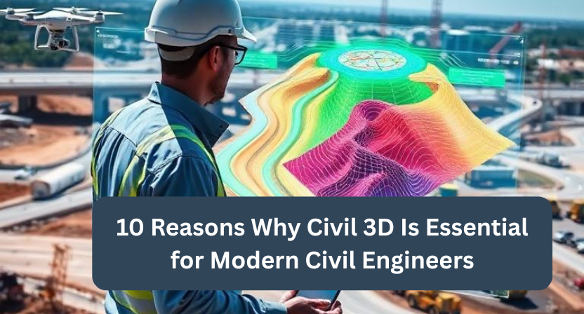
Civil 3D allows engineers to generate accurate terrain models from survey data, point clouds, GIS information, and drone surveys.
With detailed surface models, engineers can:
- Analyze slopes
- Plan grading
- Calculate cut-and-fill volumes
- Optimize drainage
- Evaluate construction feasibility
Accurate terrain modeling improves project planning and reduces unexpected site issues during construction.
5. Powerful Corridor Modeling for Roads and Highways
Road and highway projects involve complex design requirements, including alignments, cross-sections, intersections, and grading.
Civil 3D simplifies corridor modeling by allowing engineers to create intelligent road models that automatically respond to design changes.
This capability makes it easier to:
- Design highways
- Build urban roads
- Create intersections
- Develop railway corridors
- Design airport runways
The software also helps engineers evaluate multiple design alternatives before finalizing a project.
6. Better Collaboration Across Teams
Modern infrastructure projects involve architects, surveyors, contractors, structural engineers, environmental consultants, and utility designers.
Civil 3D supports collaborative workflows by allowing teams to work with shared project data while maintaining version control.
Because it integrates well with Autodesk’s ecosystem, teams can exchange information more efficiently, reducing communication gaps and avoiding duplicate work.
Improved collaboration leads to smoother project execution from planning through construction.
7. Comprehensive Quantity Takeoffs and Cost Estimation
Accurate quantity estimation plays a major role in project budgeting.
Civil 3D automatically calculates quantities for:
- Earthwork
- Materials
- Pavements
- Utilities
- Excavation
- Embankments
Since quantities update whenever the design changes, engineers always have access to current project information.
This helps project managers prepare more accurate budgets and reduce financial risks during construction.
8. Supports Sustainable Infrastructure Design
Sustainability has become a major focus in civil engineering.
Civil 3D enables engineers to create environmentally responsible designs by optimizing grading, drainage, stormwater management, and earthwork calculations.
Engineers can evaluate different design alternatives to reduce unnecessary excavation, preserve natural landscapes, and improve water management.
These capabilities support greener infrastructure projects while helping organizations meet environmental regulations.
9. Scalable for Projects of Every Size
Whether you’re designing a residential subdivision or a multi-billion-dollar transportation corridor, Civil 3D provides the flexibility to manage projects of any scale.
Its intelligent data management system allows engineers to organize large datasets efficiently without losing control over project information.
From small consulting firms to multinational engineering companies, Civil 3D adapts to different project requirements and team sizes.
This scalability makes it a long-term investment for engineering organizations.
10. Creates a Living Digital Engineering Record (A Unique Advantage)
One of the most overlooked advantages of Civil 3D is that it creates what can be considered a living digital engineering record rather than simply producing design drawings.
Traditional CAD files often become outdated once construction begins. In contrast, a well-managed Civil 3D model preserves the engineering logic behind every design decision including alignments, grading strategies, surface relationships, corridor assemblies, and design intent.
This becomes extremely valuable years after project completion.
When infrastructure requires expansion, maintenance, utility relocation, or rehabilitation, future engineering teams can understand why the original design was created instead of merely seeing what was drawn. This significantly reduces redesign time, lowers lifecycle costs, and preserves engineering knowledge across generations of projects.
For organizations managing long-term infrastructure assets, this hidden benefit can deliver value well beyond the construction phase and is one of the strongest reasons to adopt Civil 3D.
Why Civil 3D Skills Matter for Today’s Engineers
As governments and private organizations continue investing in transportation, utilities, smart cities, and sustainable infrastructure, demand for Civil 3D professionals continues to grow.
Engineers with Civil 3D expertise often have opportunities to work on:
- Highway engineering
- Urban development
- Water resources
- Land development
- Rail infrastructure
- Airport design
- Utility planning
- Smart city projects
Learning Civil 3D not only improves technical capabilities but also enhances career prospects in an increasingly digital engineering environment.
Best Practices for Getting the Most from Civil 3D
To maximize the benefits of Civil 3D, consider these best practices:
- Maintain organized templates and standardized layers.
- Use data shortcuts for collaborative projects.
- Keep survey and terrain data updated.
- Automate repetitive workflows whenever possible.
- Regularly validate models before construction documentation.
- Stay current with new Civil 3D features and updates.
Following these practices helps improve productivity while ensuring high-quality project deliverables.
Conclusion
Civil engineering continues to evolve with increasing project complexity, tighter schedules, and greater expectations for precision. In this environment, Civil 3D has become far more than a drafting tool it is a comprehensive engineering platform that supports intelligent design, improves collaboration, automates documentation, and helps engineers deliver infrastructure projects with greater confidence.
From terrain modeling and corridor design to quantity estimation and sustainable planning, Civil 3D enables professionals to work smarter while maintaining high standards of quality and accuracy. Its ability to preserve design intelligence throughout the project lifecycle makes it a valuable asset for organizations focused on long-term infrastructure success.
At Qaxles Technologies, we understand the importance of delivering accurate, efficient, and future-ready engineering solutions. Our team supports organizations with engineering design services, CAD modeling, documentation, digital engineering workflows, and product development across multiple industries. Whether you’re looking to enhance your engineering capabilities or streamline your design processes, Qaxles Technologies is committed to helping you achieve better project outcomes with reliable technical expertise.